Sonoma County sits atop a ticking seismic clock: the Rodgers Creek Fault, which runs directly beneath Santa Rosa, is considered overdue for a major rupture — and new hazard modeling makes the potential toll staggering.
Key Takeaways
- A magnitude 6.7 or greater earthquake on the Rodgers Creek Fault is projected to cause roughly 275 deaths and more than $28 billion in damage across Sonoma County.
- About 10,100 households could be displaced, with 5,000 residents needing emergency shelter.
- The Rodgers Creek Fault last ruptured significantly in the early-to-mid 1700s and carries a 33% chance of a M6.7+ quake by 2043, according to USGS estimates.
- Areas built on soft soils — the Santa Rosa Plain, Russian River silts, and southern Sonoma County near San Pablo Bay — face the highest shake intensity.
- The modeling comes from the county’s Multi-Jurisdictional Hazard Mitigation Plan and was timed to the 120th anniversary of the 1906 earthquake.
The fault beneath our feet
The Rodgers Creek Fault runs through the heart of Santa Rosa, making it the county’s most significant seismic threat. According to retired USGS geologist Suzanne Hecker, the fault is considered overdue: its last major rupture happened sometime in the early-to-mid 1700s. A USGS probability model puts the chance of a magnitude 6.7 or greater quake on the Rodgers Creek-Hayward fault system at 33% before 2043, according to the Press Democrat.
Jeff DuVall, Sonoma County’s emergency management director, told the Press Democrat the threat weighs on him constantly. “Earthquakes are what keep me awake at night,” DuVall said. Unlike wildfires, which typically allow some warning time, earthquakes strike without notice — making advance preparation the only reliable defense.
What the numbers show
The county’s Multi-Jurisdictional Hazard Mitigation Plan projects that a major Rodgers Creek rupture would kill approximately 275 people, hospitalize 1,100, and cause 3,400 additional minor injuries. Around 10,100 households would be displaced, with 5,000 residents needing short-term shelter.
The financial toll is equally sobering: estimated damages top $28 billion. More than 4,500 residential buildings, 9,500 commercial structures, and 1,700 government and educational facilities could be severely damaged or destroyed. Santa Rosa Fire Marshal Paul Lowenthal and Sonoma Water chief engineer Kent Gylfe emphasized that critical infrastructure — water lines, roads, emergency services — would all face major disruptions in the immediate aftermath.
Preparing before the ground shakes
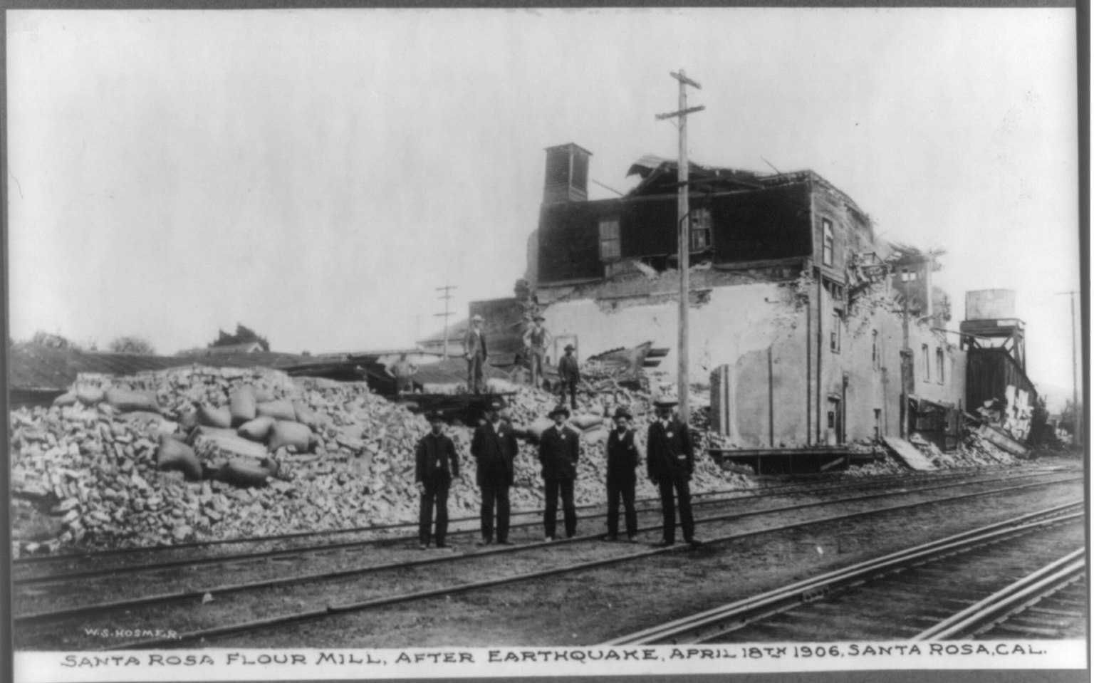
Sonoma County hosted a ShakeOut earthquake drill on April 18 — the 120th anniversary of the 1906 quake that killed at least 85 people in Santa Rosa and leveled much of the downtown business corridor. County officials say the drill is part of a broader push toward earthquake preparedness, including resource fairs and expanded public education through the SoCo Alert warning system.
The stakes are especially high as the county navigates a $2.7 billion budget under pressure from deep federal cuts — a dynamic playing out this week at the county’s annual budget workshops, where officials are weighing potential layoffs and reductions to health and emergency services. Meanwhile, spring rains arriving this week offer some seasonal relief, but county emergency managers say earthquake readiness demands the same urgency as wildfire preparedness — and the ground beneath Santa Rosa doesn’t distinguish between seasons.
Frequently Asked Questions
How likely is a major earthquake near Santa Rosa?
According to USGS estimates cited by the Press Democrat, there is a 33% chance of a magnitude 6.7 or greater earthquake on the Rodgers Creek-Hayward fault system by 2043. The Rodgers Creek Fault runs directly under Santa Rosa and has not produced a major rupture since the early-to-mid 1700s, making it overdue by seismic standards.
Which areas of Sonoma County face the greatest earthquake risk?
Areas built on soft or unconsolidated soils experience the strongest shaking in a major quake. County hazard modeling identifies the Santa Rosa Plain, low-lying areas near Russian River silts, and southern Sonoma County near San Pablo Bay as the most vulnerable zones. Buildings constructed before modern seismic codes are at particular risk.
What steps should residents take to prepare?
The Sonoma County Department of Emergency Management recommends assembling a 72-hour emergency kit with water, food, medications, and important documents, and securing heavy furniture and appliances that could topple in a quake. Residents can also sign up for SoCo Alert, the county’s free emergency notification system, at socoemergency.org.
Leave a Reply